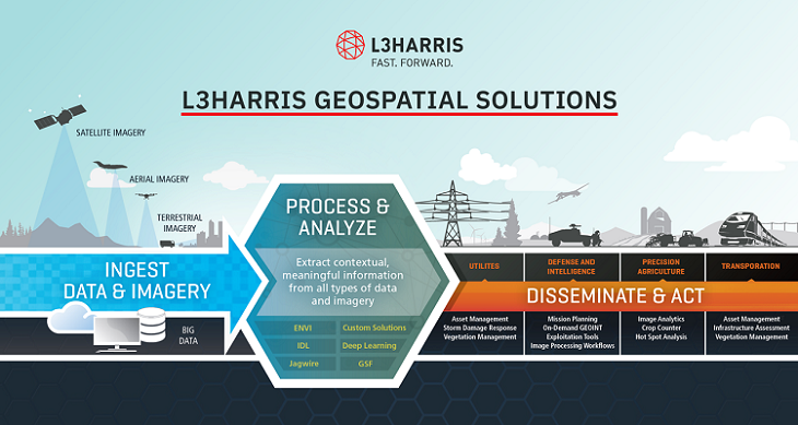
L3Harris Geospatial Solutions
L3Harris Geospatial has more than 40 years of experience developing scientifically proven solutions using cutting-edge technology. Today, organizations across industries use our in-depth knowledge of advanced geospatial analytics, machine learning to make better decisions.
ENVI is the industry standard for image processing and analysis software. It is used by image analysts, GIS professionals and scientists to extract timely, reliable and accurate information from geospatial imagery. This geospatial software is scientifically proven, easy to use and tightly integrated with Esri’s ArcGIS platform.
ENVI SARscape: Turns SAR data into meaningful, contextual information. The use of Synthetic Aperture Radar (SAR) data has become increasingly popular around the world due to its many benefits such as the ability to capture data at night and see through cloud cover. ENVI SARscape has become the industry standard: Using technology developed by SAR experts and proven over time. Easily ingest SAR data and prepare it for analysis. Quickly view, observe, monitor and extract information